|
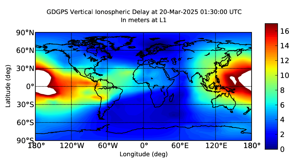
GPS users with single-frequency receivers need ionospheric electron content
information in order to achieve positioning accuracy similar to dual-frequency
receivers. The GDGPS System provides a global real-time maps of ionospheric electron
content (currently producing a map every 5 minutes).
These maps are also of value in monitoring the effect of the
ionosphere on radio signals, power grids, and on space weather.
The maps are derived using data from the ~100 real-time GDGPS tracking sites, ougmented with
additional sites that are available on an hourly basis, probing the ionosphere with high spatial
and temporal resolution. The integrated electron density data along each receiver-GPS satellite link
is processed through a Kalman filter in a sun-fixed frame to produce the global gridded maps of TEC.
The maps are available redundantly from multiple GDGPS Operations Centers (GOCs)
as images, as text files containing the gridded TEC values, or as a binary data stream
containing the gridded TEC values.
TEC values from these maps are used in correcting the ionospheric delay in arbitrary geographic localtions on Earth
for the Virtual Reference Site (VRS) data product of the GDGPS System.
|